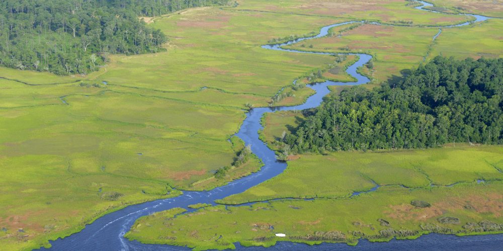
The Lower Cape Fear River Blueprint is a collaborative planning effort, led by the North Carolina Coastal Federation, to protect, manage and restore the important estuarine and riverine natural resources of the lower Cape Fear River.
With support from The Orton Foundation, the Blueprint empowers communities and partners to work together to improve the river and surrounding watershed’s overall health and water quality.
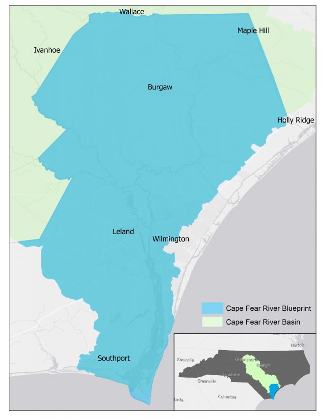
The Lower Cape Fear River Blueprint expands upon existing efforts by the Cape Fear River Partnership and Cape Fear Arch by creating a holistic platform of support and advocacy for the river and its resources. By restoring natural features like wetlands, resilient shorelines, urban tree canopies, natural forests and healthy upstream watersheds, the surrounding coastal communities can accrue quality of life benefits today, enhance fish and wildlife resources and help prepare for foreseeable resiliency challenges.
Why protecting the Lower Cape Fear River matters:
The Lower Cape Fear River provides critical coastal and riverine habitat, storm and flood protection and commercial and recreational fishery resources. It is also a popular recreational destination, an economic driver for the southeastern region of North Carolina and embodies a rich historic and cultural heritage. The river also serves as an important source of drinking water for many coastal communities, including the City of Wilmington.
The Blueprint will serve as a long-term guide to protecting the long-term health of the river by ensuring there is a clear plan in place for compatible and sustainable development. The plan will also address current pollution and habitat loss, which is negatively affecting oysters, fisheries and overall water quality. Protection of the Lower Cape Fear River is critical to the well-being of all who live, work and play in the southeastern part of the North Carolina coast.
The Blueprint’s Goals
- Goal 1: Protect and restore water quality.
- Goal 2: Have resilient living shorelines that protect water quality and natural estuarine function and provide thriving habitat for fish and wildlife.
- Goal 3: Have oyster habitats thrive and support vibrant fisheries, good water quality and resilient estuarine shorelines.
- Goal 4: Protect and preserve native coastal wetland populations that are free of invasive species Phragmites australis.
Partners
The Lower Cape Fear River Blueprint is being supported and implemented by the following partners:
- Orton Foundation, a North Carolina-based affiliate of the Moore Charitable Foundation
- Cape Fear Arch
- Cape Fear River Partnership
- North Carolina Coastal Federation
Exploring North Carolina: On the Shoulders of the River
Follow along the banks of the Lower Cape Fear river as Tracy Skrabal, coastal scientist and manager in the southeast office and Ted Wilgis, coastal education coordinator in the southeast office explain the importance of the river and the threats it faces in another episode of UNC-TV’s “Exploring North Carolina”.
Cape Fear Story Map
Follow the Cape Fear Story Map to journey down the Lower Cape Fear River. See images, maps and stories that highlight the unique and wonderful Cape Fear River Estuary.
News Coverage
Coastal Review Coverage
- New laws: Biogas, clean water funds in budget; rule tweaks
- Groups: New Hanover development request ‘sheer folly’
- Blueprint Employs Oysters’ Restorative Ability
- Blueprint: Water Quality, Living Shorelines
- Lower Cape Fear Focus of Restoration Effort
- Event to Focus on Cape Fear River Plan
- Meeting to Focus on Cape Fear Conservation
- Water Issues Are Sheinbaum’s Life Calling
- Protecting Those Special Places Along the Coast
Cape Fear River In the News
- Blueprint designed to protect Lower Cape Fear River, WWAY-TV3, May 22, 2018
- Photos: N.C. Coastal Federation unveiled a new blueprint for the Lower Cape Fear River, Star News Online, May 22, 2018
- Even as GenX conversation continues, Coastal Federation has new vision for Cape Fear, Star News Online, May 22, 2018
- Lower Cape Fear River Blueprint to be introduced at May 22 open house, Lumina News, May 10, 2018
Resources
- Coastal Federation’s Letter to the EPA
- Coastal Federation’s Comments on Triennial Review
- CES Lab’s Cape Fear River study
- DEQ overview of the Cape Fear River Basin
- DEQ’s “An Economic Analysis of Recreational and Commercial Fisheries Occurring in the Middle and Lower Cape Fear River, North Carolina” (March 2015)
- Coastal Federation’s Watershed Restoration Planning Guidebook
- Cape Fear Swamp Water Classification
- Cape Fear Community Benefits Website
- Cape Fear River Assembly
- Lower Cape Fear River Program
- UNCW’s North Carolina Shellfish Siting Tool
- Clean Cape Fear
- CFRW Clean Water Matters NC
Questions? Contact Kerri Allen, Coastal Advocate, at kerria@nccoast.org or 910-509-2838