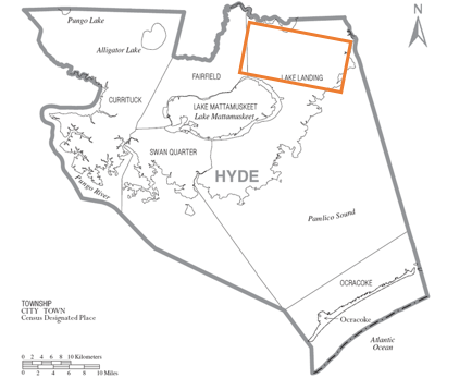
Mattamuskeet Association
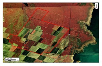
The Mattamuskeet Association is a 42,500-acre (approximately 64 square miles) private non-profit association of landowners in Hyde County. Its mission is to provide drainage, flood control, maintained access, and utility conveyance to its members. It has been the focus of wetland and hydrologic restoration efforts for the Federation since 2003.
In 2012, the Federation, Mattamuskeet Association, Natural Resources Conservation Service (NRCS), and other stakeholders developed a watershed restoration plan for the Association.
The plan provides a long-term management framework for restoring and replicating the natural hydrology of the lands in the Association. It does this by reducing and treating stormwater that was traditionally pumped through canals into Otter Creek, Pamlico Sound, the Intracoastal Waterway, and the Alligator River. These areas of water have experienced water quality impairments since the mid-1980s.
The Plan identifies five objectives that focus on restoring the Mattamuskeet Association’s natural hydrology and reducing water flow directly into the Pamlico Sound. The Plan calls for drainage water redirected to historic flow paths and areas where hydrology has been severely altered. This strategy is aimed at improving the water quality in closed shellfishing waters, improving wetland conditions in the new receiving areas, and maintaining water management capabilities for the Association. The plan also identifies 12 major projects that once complete will restore or enhance nearly 10,500 acres of prior converted wetland.
Plan Implementation Through Restoration
The Federation spearheaded wetland restoration efforts within the association to implement the plan in a phased approach.
The primary goal of these projects is to restore hydrology and habitat on primarily ditched and drained farmland that had been earlier converted to other conservation uses. By recreating historic drainage flow patterns and habitats, water quality in downstream estuaries should be improved. The re-created wetlands retain, filter and provide natural treatment of agricultural runoff from remaining upstream farms. They are also effective at restoring watershed hydrology, trapping sediments, converting nutrients, and reducing flow to downstream coastal waters. Projects that reduce discharges of drainage directly into shellfish waters have been made a priority.
Since the plan was approved, several of the projects have been designed, engineered, and implemented.
Wetland Enhancement Project, L1
- Restoration in Progress: 1,400 acres of forested wetlands enhanced to restore historic hydrology.
- Restoration design: N.C. State University Biological and Agricultural Engineering Department and U.S. Department of Agriculture Natural Resources Conservation Service
- Restoration technique: Two pump stations are designed to lift water into the 1,400-acre block. Cypress sloughs, berms, baffles, and water control structures are used to manage water levels as prescribed by a water management plan. Water levels are managed to restore hydrology and improve habitat, water quality, and water management capabilities.
- Funding: N.C. Clean Water Management Trust Fund, Natural Resources Conservation Service, Wetland Reserve Program, Mary Cary Flagler Charitable Trust Fund
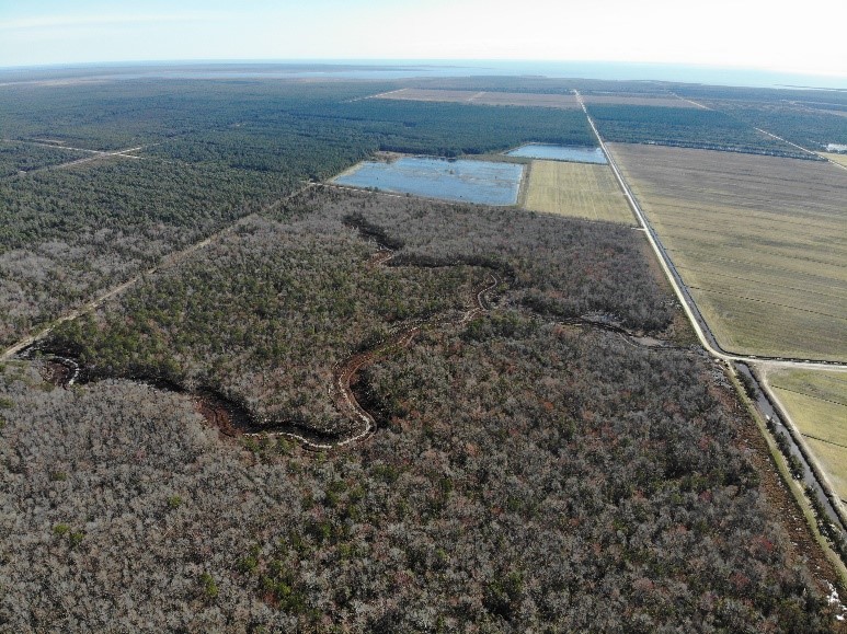
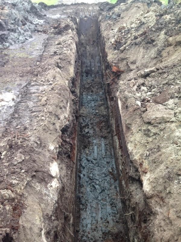
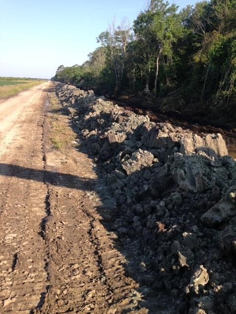
Earthen Core Project, Association Perimeter
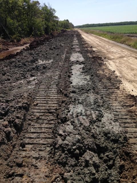
Monitoring by NRCS soil scientists and modeling by North Carolina State University researchers indicated that the restoration projects would be further enhanced by creating a mineral soil core around the perimeter of the projects and the association. This core reduces the seepage of water out of the wetlands back into the association’s drainage system. Without it, water would be handled twice. It also helps to limit water seepage from out of the association into the association infrastructure. Modeling indicates that additional coring projects could reduce water management needs by 20%.
- To date, approximately 2.5 miles of the association’s 12.5-mile northern perimeter have been cored in this way.
- Funding: N.C. Department of Environmental Quality 319 program and N.C. Attorney General’s Environmental Enhancement Program
- Completion: 2 miles in 2018, additional 0.5 miles in 2019.
Wetland Enhancement Project, MV 1
- Acres restored: 1,350 acres
- Restoration design: Mattamuskeet Management and Consulting
- Restoration techniques: One pump station was installed to lift water into the restored area. Water levels are managed to improve water quality and facilitate the establishment of Atlantic white-cedar (juniper) and other bottomland hardwood trees.
- Funding: N.C. Clean Water Management Trust Fund, Albemarle Pamlico National Estuary Partnership
- Completion: June 2014
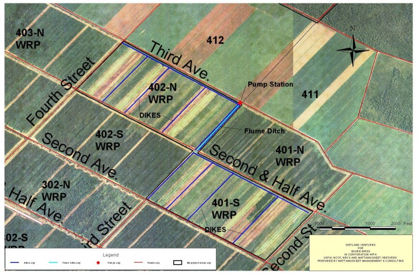
Shorebird Project
- Acres restored: 600 acres of wetlands enhanced to create habitat for migrating shorebirds, water quality benefits, and improved water management.
- Restoration design: U.S. Fish and Wildlife Services and Mattamuskeet Management and Consulting
- Restoration technique: A small, 24-inch diesel pump was installed to lift water into the 600-acre area. Interior dikes, berms, and water control structures manage water levels as prescribed by a water management plan. Water levels are managed to create mudflats and shallow water areas that attract migrating shorebirds
- Funding: U.S. Fish and Wildlife Services and Albemarle Pamlico National Estuary Partnership
- Completion: December 2010